Tucked away in Bueng Kan, one of Thailand’s least-visited provinces, Phu Langka has quietly emerged as one of the country’s most remarkable nature destinations. While the province remains largely undiscovered by international travelers, this mountain has become an icon of the region.
Local communities regard Phu Langka as a sacred mountain associated with the mythical Naga, the serpent deity deeply woven into the culture of the Mekong region. For nature lovers, however, the mountain tells another story—one written by water, wind, and time. Sandstone cliffs, natural rock shelters, unusual geological formations, and lush waterfalls combine to create a landscape that feels both mysterious and alive.
A Journey Across the Sandstone Highlands
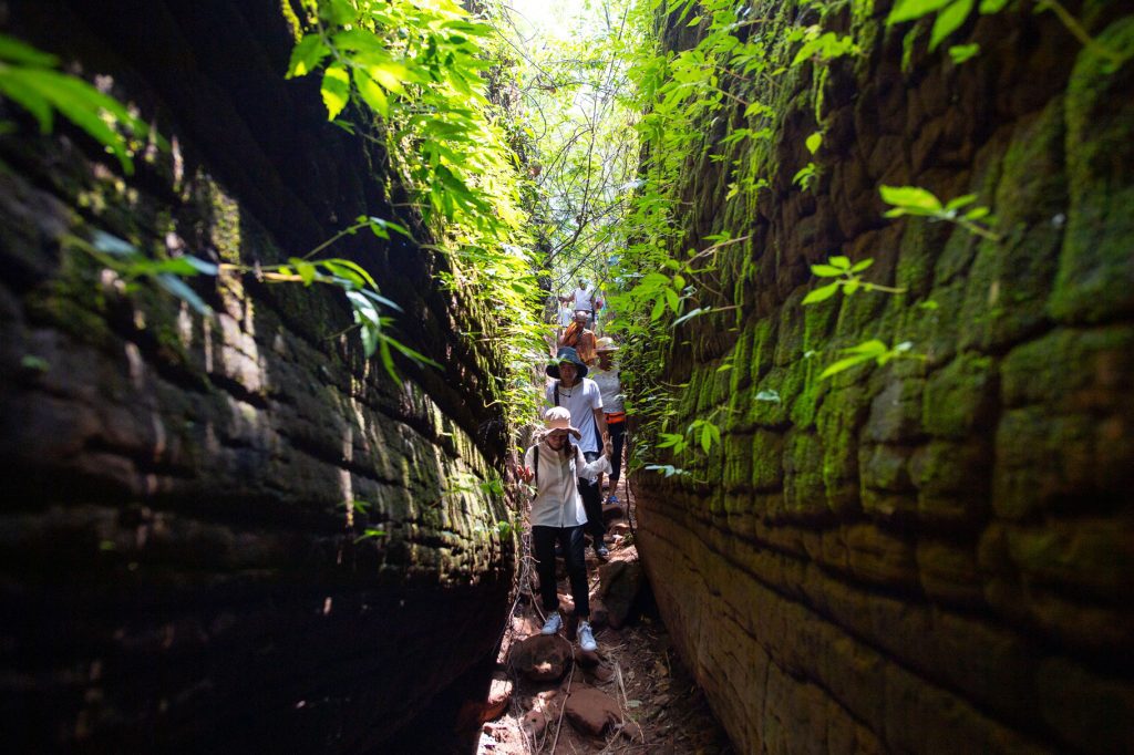
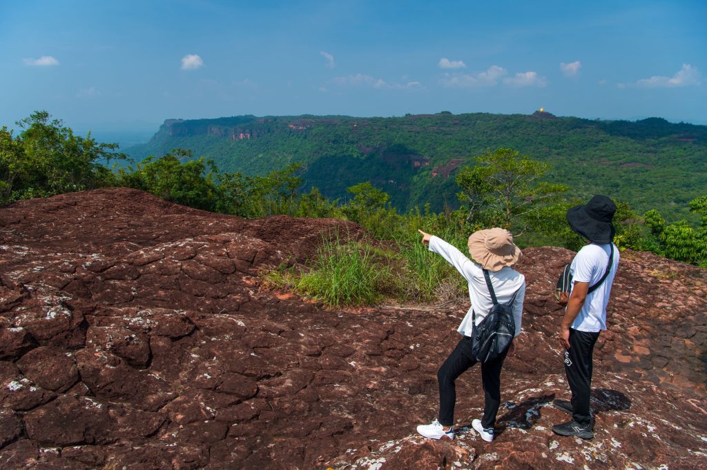
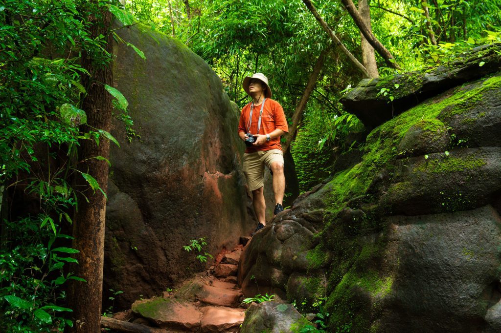
Like many mountains in northeastern Thailand, Phu Langka is a sandstone plateau rising above the surrounding landscape. Reaching the summit requires some effort. The trail climbs steadily through the forest, with several steep sections that quickly raise the heart rate.
Yet the journey itself is part of the reward. The route passes through rich vegetation nourished by seasonal rainfall, offering changing views of forest, rock formations, and mountain scenery along the way.
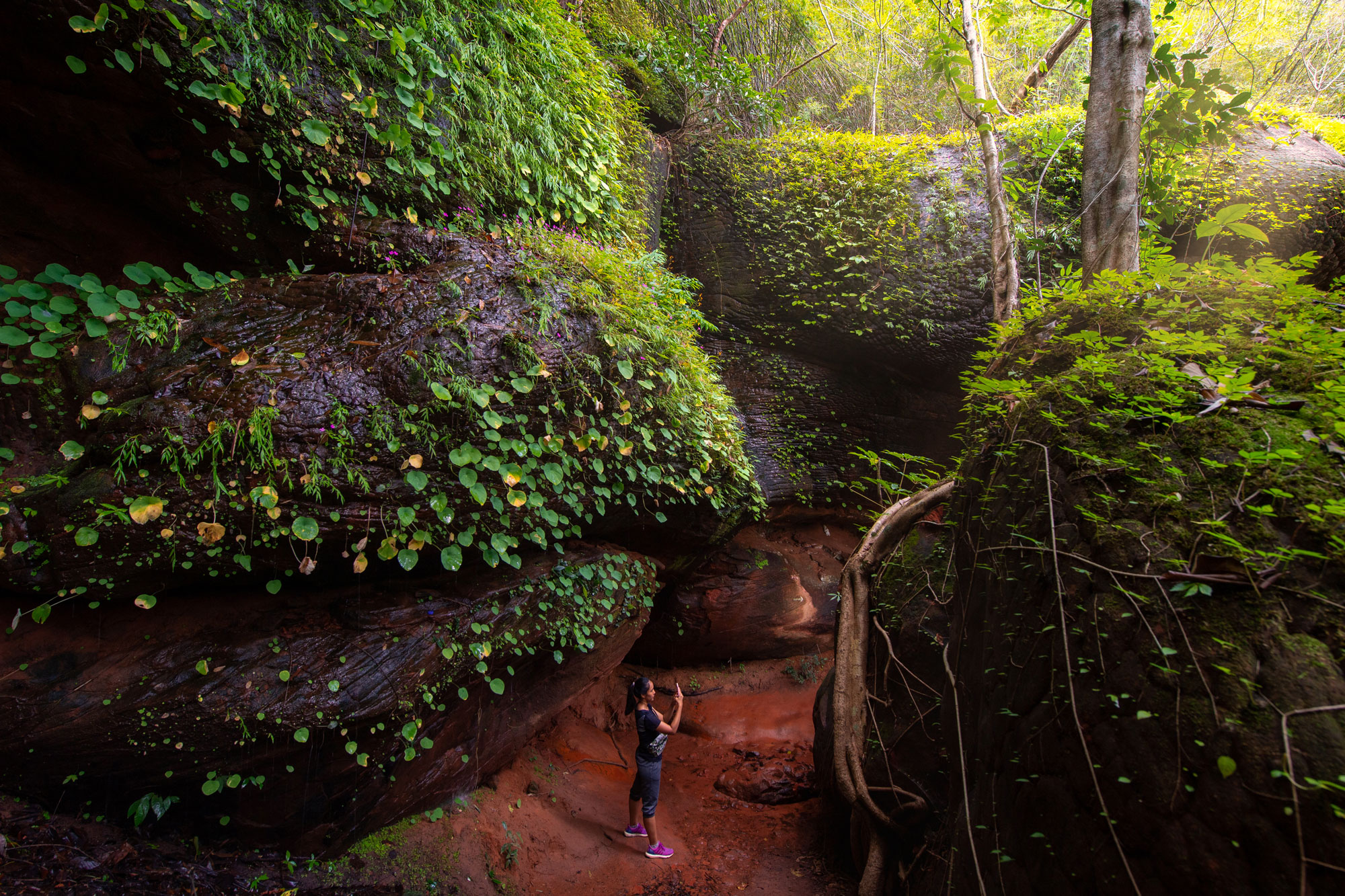
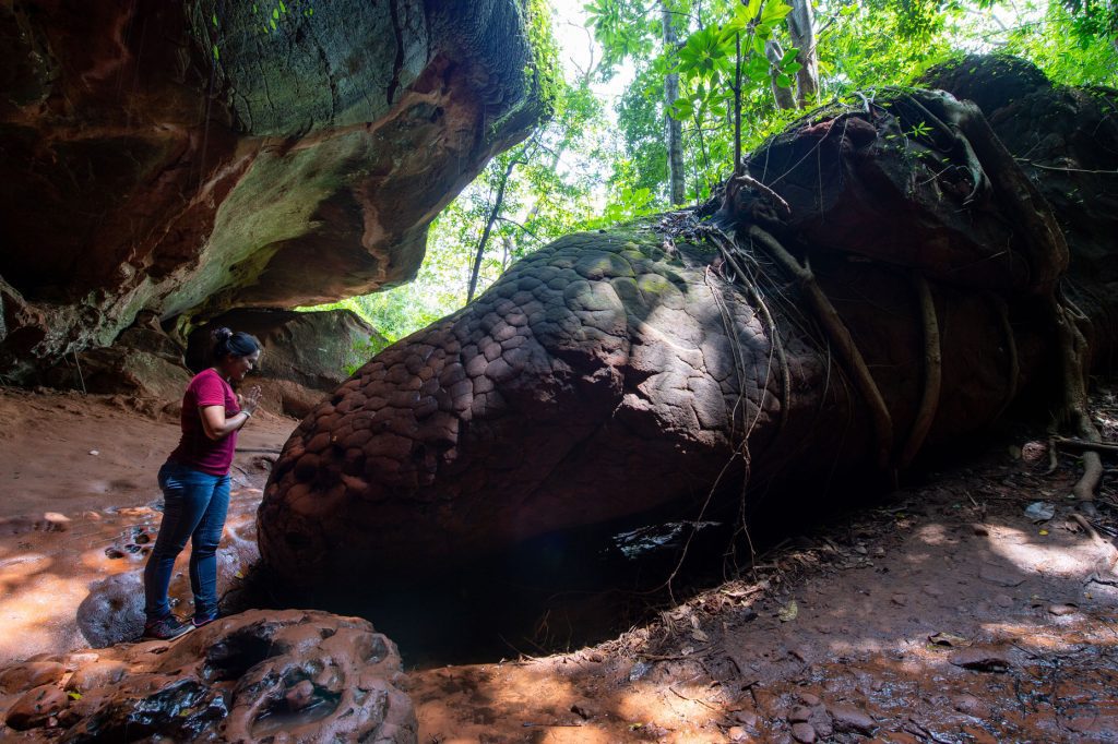
The mountain’s sandstone geology has played a defining role in shaping its appearance. Over millions of years, rainwater and natural erosion have sculpted the rock into a variety of unusual forms. In many places, cracks and patterns spread across the stone surfaces, creating textures that resemble the scales of a mythical dragon.
For local people, these formations are linked to legends of the Naga and are considered evidence of the mountain’s spiritual significance. From a geological perspective, they are equally fascinating—an extraordinary example of how natural forces can transform a landscape over time.
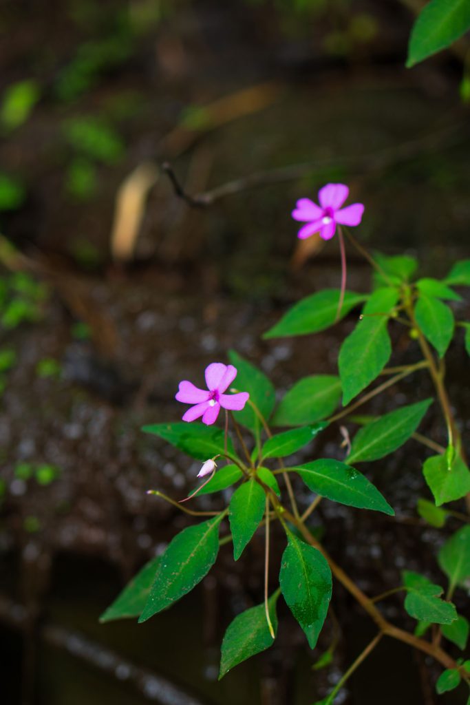
During the rainy season, the trail becomes even more vibrant. Wildflowers bloom among the rocks and forest floor, while mushrooms emerge in surprising shapes and colors. Together they create a living reminder of the moisture and fertility that define this season.
Following the Water to Tat Wimanthip Waterfall
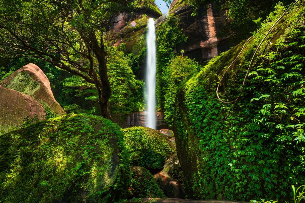
One of the highlights of Phu Langka is Tat Wimanthip Waterfall, a beautiful cascade fed by streams originating on the mountain itself.
The journey to the waterfall is an adventure in its own right. Visitors follow the stream through the forest, crossing shallow water and exploring different sections of the falls along the way. Each level reveals a different character—some broad and gentle, others narrow and dramatic.
During the rainy season, the waterfall reaches its full beauty. Water flows powerfully through the forest, moss covers the rocks in shades of green, and the surrounding landscape feels fresh, cool, and full of life.
For travelers seeking a deeper connection with nature, Phu Langka offers something increasingly rare: a landscape shaped not by human hands, but by the enduring relationship between stone, water, and time.
Quick Info
- Phu Langka National Park is located in Bueng Kan Province. The nearest airport is Nakhon Phanom Airport, approximately 115 km away, with a travel time of around 2–3 hours. Visitors can rent a car or arrange a private van transfer from the airport.
- The hiking trail connecting Naka Cave and Tat Wimanthip Waterfall is approximately 4.5 km long. The route is steep and physically demanding in some sections, with a round-trip hiking time of around 4–6 hours.
- Visitors are required to reserve entry in advance through the QueQ application by selecting Phu Langka National Park and choosing their preferred date and time.
- A local guide is mandatory for the hike. Guides are managed by the national park, with fees ranging from THB 500–1,000 per group, depending on the group size.
- The best time to visit is during the rainy season, from June onwards, when the forest is at its greenest and waterfalls are flowing at their fullest.
Share


